
onX Backcountry Trail Maps GPS Price Snapshot
onX Backcountry Trail Maps GPS by onXmaps is free to download on the Google Play, and offers in-app purchases. It holds a 4.4★ rating from 2.3K reviews.
Listing last updated: 2026-03-03. Source: public Google Play data, compiled via the App Pricing Lab methodology.
4.4★
2.3K reviews
500.0K
Installs
Nov 27, 20
Released
2026-03-03
Last Updated
Rankings
| Category | Collection | Rank | Date |
|---|---|---|---|
| SPORTS | topgrossing | #32 | 2026-03-10 |
| SPORTS | topselling_free | #60 | 2026-03-10 |
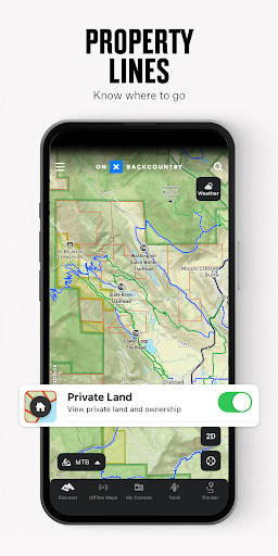
Screenshots


About onX Backcountry Trail Maps GPS
Discover new trails and backcountry skiing lines. Navigate through hikes, climbing routes, and mountain bike trails. Whether you’re scouting new terrain or navigating maps in the field, onX Backcountry is the ultimate app for offline outdoor recreation.
Plan your hiking, skiing, mountain biking, and climbing activities with trustworthy data. HD topographic maps, GPS tracking, and weather forecasts help you navigate confidently in unknown terrain. Toggle map layers to show nearby hazards such as wildfires or avalanches. Measure distance and elevation, and visualize your trip in 3D, even without cell service.
Map out custom routes seamlessly with our snap-to-trail feature and prepare in granular detail by setting Waypoints and reviewing Slope data. View localized weather and hour-by-hour wind forecasts. Discover adventures nearby with 650,000+ miles of trails, 300,000+ rock climbs, and 4,000+ ski routes.
Download 3D maps for offline use and leave a breadcrumb trail with Tracker to measure key trip stats. See in-depth terrain features with high definition topo maps and switch between Hike, MTB, Climb, or Ski Tour for an app that covers all your adventure needs.
Navigate confidently with powerful map tools and go farther with onX Backcountry today.
onX Backcountry Features:
▶ Ultimate GPS Map App for Outdoor Pursuits
• View trail maps in 3D, HD topo, satellite imagery or hybrid to visualize terrain
• Hiking, skiing, biking, and climbing become easier with custom map routes
• GPS tracking to know where you came from and share your trip
• Set Waypoints and access data on Slope Angle, Slope Aspect, and Trail Slope
▶ Map Modes for Every Adventure
• Hiking – Trail lengths, difficulty levels, elevation, and real-time GPS
• Backcountry skiing & snowboarding – Slope angles, SNOTEL data, and ATES layers
• Mountain biking – Biking paths, difficulty ratings, trail conditions, and elevation
• Rock climbing – Climbing routes, climb types, GPS tracking, and user reviews
▶ Navigate Offline without Cell Coverage
• Download 3D maps with interactive trail data. Turn your phone into a handheld GPS
• Track your location and follow the blue dot to get back to your starting point
• Measure hiking, biking, climbing or skiing stats to see where you’ve been
• View distance or elevation gain in seconds as you navigate in the field
▶ Scout Ahead & Stay Safe on your Trip
• Use the compass to find your location and orient yourself
• Access localized weather conditions, 7-day weather forecasts, and hourly wind data
• Hike confidently with Trail Reports. Submit current conditions and trail closures
• Plan ahead with ATES, wildfire, air quality, and smoke density layers
Your Four-Season Outdoor App
onX Backcountry brings everything you need for your outdoor adventures into one place. Download and start your next journey today!
▶ Free Trial
Start a Premium or Elite trial for free when you install the app. Maximize your backcountry experience and access all of our best fe
Frequently Asked Questions
Is onX Backcountry Trail Maps GPS free?
Yes, onX Backcountry Trail Maps GPS is free to download. It offers in-app purchases.
What is the rating of onX Backcountry Trail Maps GPS?
onX Backcountry Trail Maps GPS has a 4.4 out of 5 star rating based on 2.3K reviews on the Google Play.
Who made onX Backcountry Trail Maps GPS?
onX Backcountry Trail Maps GPS was developed by onXmaps. Visit their website at http://www.onxmaps.com.
Developer
Explore More
Related Sports Apps
Share & Embed
Use these badges on your website or blog to link back to this app's data.
Rating Badge
<a href="https://apppricinglab.com/app/google_play/onxmaps.backcountry"><img src="https://apppricinglab.com/api/badge/rating?store=google_play&app=onxmaps.backcountry" alt="onX Backcountry Trail Maps GPS rating on App Pricing Lab" /></a>IAP Badge
<a href="https://apppricinglab.com/iap/google_play/onxmaps.backcountry"><img src="https://apppricinglab.com/api/badge/iap?store=google_play&app=onxmaps.backcountry" alt="onX Backcountry Trail Maps GPS IAP prices on App Pricing Lab" /></a>Rank Badge
<a href="https://apppricinglab.com/app/google_play/onxmaps.backcountry"><img src="https://apppricinglab.com/api/badge/rank?store=google_play&app=onxmaps.backcountry" alt="onX Backcountry Trail Maps GPS ranking on App Pricing Lab" /></a>